 |
201-19. Nahal Sekhvee River north from Safed, landscape of a wadi in Upper Galilee. The Middle East, April 19, 2001Similar picturesLarge thumbnails | Use small thumbnails | View as slideshow |
|
201-19. Nahal Sekhvee River north from Safed, landscape of a wadi in Upper Galilee. The Middle East, April 19, 2001Similar picturesLarge thumbnails | Use small thumbnails | View as slideshow |
 Canyon of Nahal Sekhvee River north from Safed. The Middle East, April 19, 2001  Ancient donkey path from Safed to the mills of Nahal Ammud along Nahal Sekhvee River. The Middle East, April 19, 2001  Ancient trail along Nahal Sekhvee River near Safed. The Middle East, April 19, 2001  Ancient trail along Nahal Sekhvee River near Safed. The Middle East, April 19, 2001  An orchid flower on a trail along Nahal Sekhvee River near Safed. The Middle East, April 19, 2001  Houses in Safed (also spelled Safad, Zefat, Tzfat, Tsfat, Zfat, Safet, Safes, etc.) in Upper Galilee. The Middle East, April 19, 2001  Mills (?) at Nahal Ammud River near Safed. The Middle East, April 19, 2001  A mill near Ein Po em spring at Nahal Ammud River near Safed. The Middle East, April 19, 2001  Iscandria flour mill (?) at Nahal Ammud River near Safed. The Middle East, April 19, 2001  Nahal Ammo river in Galilee, view from Road 85. The Middle East, April 7, 2001  The fruit garden (bustan) watered from a spring at Nahal Ammud River near Safed. The Middle East, April 19, 2001  Upper Nahal Darokh river 5 miles east from Sde Boker. The Middle East, April 9, 2001  Upper Nahal Darokh river 5 miles east from Sde Boker. The Middle East, April 9, 2001  Upper Nahal Darokh river 5 miles east from Sde Boker. The Middle East, April 9, 2001  Upper Nahal Darokh river 5 miles east from Sde Boker. The Middle East, April 9, 2001  Dried stream going to upper Nahal Darokh river 5 miles east from Sde Boker. The Middle East, April 9, 2001  A ridge in Hatira Mountains 4 miles east from Sde Boker, near the upper Nahal Hatsats river. The Middle East, April 9, 2001  Sky seen through caves in the upper side of the horseshoe formation of Nahal Darokh river 4 miles east from Sde Boker. The Middle East, April 9, 2001  Upper side walls of the horseshoe formation of Nahal Darokh river 4 miles east from Sde Boker. The Middle East, April 9, 2001  Caves in the upper side walls of the horseshoe formation of Nahal Darokh river 4 miles east from Sde Boker. The Middle East, April 9, 2001  Blackened brain-like stones in limestone in Hatira Mountains 4.5 miles east from Sde Boker, near the upper Nahal Hatsats river. The Middle East, April 9, 2001  Landscape near Nahal Nekarot River at southern side of Ramon Crater, 6 miles south-east from Mitzpe Ramon. The Middle East, May 3, 2001  Desert landscape of canyon of Nahal Akev wadi, 2.5 miles east from Avdat. The Middle East, November 17, 2002  Old olive trees near Karmiel in Upper Galilee, view from Road 85. The Middle East, April 19, 2001  Upper Nahal Amir wadi, 5 miles north from Eilat. The Middle East, March 25, 2002  Upper Nahal Amir wadi, 5 miles north from Eilat. The Middle East, March 25, 2002  Upper part of Nahal Raham wadi 6 miles north from Eilat. The Middle East, March 14, 2002  Nahal Keziv river, 1 mile north-west from Mi ilia. Galilee, the Middle East, March 31, 2002  Nahal Keziv river 2.5 miles north-west from Mi ilia. Galilee, the Middle East, March 31, 2002  Nahal Keziv river below Ein Tamir spring, north from Mi ilia. Galilee, the Middle East, March 31, 2002  Nahal Keziv river below Ein Tamir spring, north from Mi ilia. Galilee, the Middle East, March 31, 2002  Nahal Keziv river near Ein Tamir spring, north from Mi ilia. Galilee, the Middle East, March 31, 2002  Upper Nahal Amir wadi, view to the south, 5 miles north from Eilat. The Middle East, March 25, 2002  Canyon of Nahal Keziv river 2.5 miles north-west from Mi ilia. Galilee, the Middle East, March 31, 2002  A trail above Nahal Keziv river, 1 mile north-west from Mi ilia. Galilee, the Middle East, March 31, 2002  Desert landscape of Nahal Akev creek canyon, 2.5 miles east from Avdat. The Middle East, February 15, 2001  View of canyon of Nahal Keziv river from trail 2223, 2 miles north-west from Mi ilia. Galilee, the Middle East, March 31, 2002  A lower house of Montfort Castle at Nahal Keziv river 2.5 miles north-west from Mi ilia. Galilee, the Middle East, March 31, 2002  A lower building of Montfort Castle near a dam of Nahal Keziv river 2.5 miles north-west from Mi ilia. Galilee, the Middle East, March 31, 2002  Wadi Natuf valley in Neot Kedumim biblical landscape park, west from Jerusalem. The Middle East, February 7, 2001  View from trail 2223 overlooking canyon of Nahal Keziv river, 2 miles north-west from Mi ilia. Galilee, the Middle East, March 31, 2002  Flowers along trail 2223 overlooking canyon of Nahal Keziv river, 2 miles north-west from Mi ilia. Galilee, the Middle East, March 31, 2002  Wadi in the area of Nahal Tseelim, view to the north from Mount Eliazar, near the Dead Sea. The Middle East, November 8, 2001  View to the north from the upper Nahal David. Ein Gedi, the Middle East, March 29, 2001  View of a sky to the north from the upper Nahal David. Ein Gedi, the Middle East, March 29, 2001  View of a sky to the north from the upper Nahal David. Ein Gedi, the Middle East, March 29, 2001  View of a sky to the north from the upper Nahal David. Ein Gedi, the Middle East, March 29, 2001  View to the north from the upper Nahal David. Ein Gedi, the Middle East, March 29, 2001  View of a cave from trail 2223 overlooking canyon of Nahal Keziv river, 2 miles north-west from Mi ilia. Galilee, the Middle East, March 31, 2002  Upper pools of Nahal Arugot river in Ein Gedi park. The Middle East, April 4, 2002  Upper pools of Nahal Arugot river in Ein Gedi park. The Middle East, April 4, 2002  Springs of upper pools of Nahal Arugot river in Ein Gedi park. The Middle East, April 4, 2002  Narrowing of the canyon of Nahal Mapalim creek, wadi of the falls , 3 miles north-west from Eilat. The Middle East, March 22, 2001  Nahal Darokh river 4.5 miles east from Sde Boker. The Middle East, April 9, 2001  Nahal Darokh river 4.5 miles east from Sde Boker. The Middle East, April 9, 2001  Caves at Nahal Darokh river 4.5 miles east from Sde Boker. The Middle East, April 9, 2001  Wadi Natuf valley with Wayfarer s shelter and cave cistern in Neot Kedumim biblical landscape park, west from Jerusalem. The Middle East, February 7, 2001  Steep parts of Nahal Darokh river 4.5 miles east from Sde Boker. The Middle East, April 9, 2001  View from caves at Nahal Darokh river 4.5 miles east from Sde Boker. The Middle East, April 9, 2001  A hill near a waterfall of Nahal Darokh river 4.5 miles east from Sde Boker. The Middle East, April 9, 2001  Nahal Darokh river below the horseshoe formation, 4 miles east from Sde Boker. The Middle East, April 9, 2001  Chalk hills at Nahal Darokh river 4 miles east from Sde Boker. The Middle East, April 9, 2001  Chalk hills at Nahal Darokh river 4 miles east from Sde Boker. The Middle East, April 9, 2001  Chalk hills at Nahal Darokh river 4 miles east from Sde Boker. The Middle East, April 9, 2001  Upper Nahal Mapalim creek north from Mount Shelomo, 3 miles north-west from Eilat. The Middle East, March 22, 2001  Upper part of Nahal Shani river, 9 miles north from Eilat. The Middle East, February 7, 2002  Open parts of Nahal Darokh river on Zin valley 4 miles east from Sde Boker. The Middle East, April 9, 2001  A waterfall and a trail bypassing it on Nahal Darokh river 4.5 miles east from Sde Boker. The Middle East, April 9, 2001  View of a big pool behind the second fall of Nahal Darokh river 4 miles east from Sde Boker. The Middle East, April 9, 2001  A big pool with mosquito larvae behind the second fall of Nahal Darokh river 4 miles east from Sde Boker. The Middle East, April 9, 2001  Thorny plants near a small pool of Nahal Darokh river 4.5 miles east from Sde Boker. The Middle East, April 9, 2001  Middle part of the Dry Canyon in the upper Nahal David. Ein Gedi, the Middle East, March 29, 2001  Mysterious black stones collected on a terrace near Nahal Darokh river 4.5 miles east from Sde Boker. The Middle East, April 9, 2001  Caves with traces of a dried spring on the left, at Nahal Darokh river 4.5 miles east from Sde Boker. The Middle East, April 9, 2001  Gnawed skull of a small animal in a cave at Nahal Darokh river 4.5 miles east from Sde Boker. The Middle East, April 9, 2001 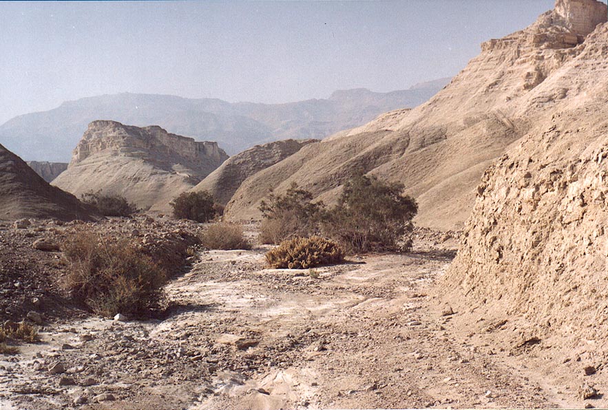 Wadi of Nahal Pratzim, west from Mount Sdom. The Middle East, December 27, 2001  Open parts of Nahal Darokh river on Zin valley, with the horseshoe formation on the background, 4 miles east from Sde Boker. The Middle East, April 9, 2001  Caves along the trail on the eastern side of the horseshoe formation of Nahal Darokh river 4 miles east from Sde Boker. The Middle East, April 9, 2001  Tributary of Nahal Darokh river going through chalk hills 4 miles east from Sde Boker, view from lower site. The Middle East, April 9, 2001  Nahal Shani wadi approaching Nahal Raham, 8 miles north from Eilat. The Middle East, February 7, 2002  Nahal Shani wadi approaching Nahal Raham, 8 miles north from Eilat. The Middle East, February 7, 2002  Chalky wadi of Nahal Pratzim, west from Mount Sdom. The Middle East, December 27, 2001  Under acacia in Nahal Shani wadi approaching Nahal Raham, 8 miles north from Eilat. The Middle East, February 7, 2002  Acacia in Nahal Shani wadi approaching Nahal Raham, 8 miles north from Eilat. The Middle East, February 7, 2002  Nahal Tseelim River, 2 miles north from Masada. The Middle East, January 20, 2001  Fresnel-shaped patterns on yellow limestone at the bottom of small caves of Nahal Darokh river 4.5 miles east from Sde Boker. The Middle East, April 9, 2001  A succulent plant in Nahal Shani wadi approaching Nahal Raham, 8 miles north from Eilat. The Middle East, February 7, 2002  End of the Dry Canyon in the upper Nahal David. Ein Gedi, the Middle East, March 29, 2001  Beginning of upper Nahal David. Ein Gedi, the Middle East, March 29, 2001  Nahal Tseelim River Canyon, 2 miles north from Masada. The Middle East, January 20, 2001  Limestone along Nahal Tseelim River, 2 miles north from Masada. The Middle East, January 20, 2001  Nahal Tseelim River and Dead Sea, 2 miles north from Masada. The Middle East, January 20, 2001 |


