 |
214-22. Watermelon field east from Nizzanim. The Middle East, July 19, 2001Similar picturesLarge thumbnails | Use small thumbnails | View as slideshow |
|
214-22. Watermelon field east from Nizzanim. The Middle East, July 19, 2001Similar picturesLarge thumbnails | Use small thumbnails | View as slideshow |
 Shells and sea foam on the beach in Nizzanim. The Middle East, July 19, 2001  Prickly pears (sabra) cactus on the roadside in Nizzanim. The Middle East, July 19, 2001  A hummingbird (?) sitting on an agave flower behind the entrance to Nizzanim beach. The Middle East, July 19, 2001  Dunes along a road north from Ashkelon, near Tel Poran in Nizzanim reserve. The Middle East, April 5, 2001  A trail going east from Mount Tzefahot to Field Study School, near Coral Beach 3 miles south-east from Eilat. The Middle East, January 13, 2001  A trail to Eilat Field School on Coral Beach 3 miles south-east from Eilat. The Middle East, January 13, 2001  Ruins of the village of Soofla, 3 miles east from Beit Shemesh. The Middle East, July 5, 2001 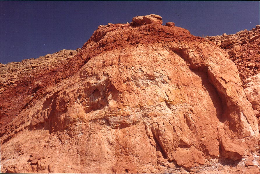 Makhtesh Ramon (crater) below Hanegev Field Station. The Middle East, October 18, 2001  Makhtesh Ramon (crater) below Hanegev Field Station. The Middle East, October 18, 2001  Destroyed houses of Bet Atab village, 4 miles east from Beit Shemesh. The Middle East, July 5, 2001  A hilltop with ruins of Bet Atab village, 4 miles east from Beit Shemesh. The Middle East, July 5, 2001  Remains of a big hall in Bet Atab village, 4 miles east from Beit Shemesh. The Middle East, July 5, 2001  A cave in the abandoned village Soofla, 3 miles east from Beit Shemesh. The Middle East, July 5, 2001  A garden in the abandoned village Soofla, 3 miles east from Beit Shemesh. The Middle East, July 5, 2001  A garden in the abandoned village of Soofla, 3 miles east from Beit Shemesh. The Middle East, July 5, 2001  A gate in the wall (?) of Bet Atab village, 4 miles east from Beit Shemesh. The Middle East, July 5, 2001  Succulent plants on a hill 2 miles north-east from Beit Shemesh. The Middle East, July 5, 2001  A gate in the wall of Bet Atab village, 4 miles east from Beit Shemesh. The Middle East, July 5, 2001  Debris of the destroyed houses of Bet Atab village, 4 miles east from Beit Shemesh. The Middle East, July 5, 2001  Ruins of a fortress (?) and walls of Bet Atab village, 4 miles east from Beit Shemesh. The Middle East, July 5, 2001  Remains of settlements and gardens on slopes of hills 2 miles north-east from Beit Shemesh. The Middle East, July 5, 2001  Bones inside one of columbarium caves in Bet Atab village, 4 miles east from Beit Shemesh. The Middle East, July 5, 2001  Ancient columbarium caves (?) in an abandoned Arab village of Bet Atab, 4 miles east from Beit Shemesh. The Middle East, July 5, 2001  A creek with basalt rocks in Makhtesh Ramon (crater) below Hanegev Field Station. The Middle East, October 18, 2001  Ancient ruins above Ein Gedi Field School (free back entrance to the park) with Dead Sea on background. The Middle East, November 15, 2001  Beginning of the lower Nahal Peres Canyon 1 mile north-east from Tamar ascent to Dead Sea (Road 25), 17 miles east from Dimona, view to the west. The Middle East, May 10, 2001  Multicolored sands at the bottom of Ramon Crater, view to the east, 4 miles south-east from Mitzpe Ramon. The Middle East, May 3, 2001  Ramon Crater east from Mitzpe Ramon, view to south-east from picnic place at Ardon Creek. The Middle East, December 19, 2001  Ramon Crater east from Mitzpe Ramon, view to south-east from picnic place at Ardon Creek. The Middle East, December 19, 2001  Ramon Crater east from Mitzpe Ramon, view to south-east from picnic place at Ardon Creek at evening. The Middle East, December 19, 2001  Ramon Crater east from Mitzpe Ramon, view to south-east from picnic place at Ardon Creek at evening. The Middle East, December 19, 2001  View to north-east along southern side of Ramon Crater near Ammonites wall, 6 miles south-east from Mitzpe Ramon. The Middle East, May 3, 2001  A hill at the bottom of Ramon Crater, view to the east, 3 miles south-east from Mitzpe Ramon. The Middle East, May 3, 2001  A hill at the bottom of Ramon Crater, view to the east, 3.5 miles south-east from Mitzpe Ramon. The Middle East, May 3, 2001  Southern side of Ramon Crater near the road to Eilat, view to the east from Ramon s Tooth, 5 miles south-east from Mitzpe Ramon. The Middle East, May 3, 2001  A summit of Ramon s Tooth, view to the east, with Ramon Crater to the left, 5 miles south-east from Mitzpe Ramon. The Middle East, May 3, 2001  A summit of Ramon s Tooth, view to the east, with Ramon Crater to the left, 5 miles south-east from Mitzpe Ramon. The Middle East, May 3, 2001  A summit of Ramon s Tooth, view to the east, with Ramon Crater to the left, 5 miles south-east from Mitzpe Ramon. The Middle East, May 3, 2001  Akko Bay from Wall s Beach east from Old Acre. The Middle East, June 7, 2001  Nahal Darokh river 4.5 miles east from Sde Boker. The Middle East, April 9, 2001  A plant in a riverbed in Zin valley, 3 miles east from Sde Boker. The Middle East, April 9, 2001  Red Sea and mountains near Taba, 3 miles south-east from Eilat. The Middle East, January 13, 2001  Red Sea and mountains near Taba, 3 miles south-east from Eilat. The Middle East, January 13, 2001  Nahal Darokh river 4.5 miles east from Sde Boker. The Middle East, April 9, 2001  Mountains near Taba, 3 miles south-east from Eilat. The Middle East, January 13, 2001  Bottom of the crater, down from Mitzpe Ramon, view to the east. The Middle East, December 6, 2001  A Roman camp east from Masada hill, near the Dead Sea. The Middle East, November 8, 2001  An ancient riverbed (?) on a trail 1.5 miles east from Avdat. The Middle East, February 15, 2001  Tzin Valley south-east from Sde Boker college. The Middle East, December 17, 2001  Mountains near Taba, 3 miles south-east from Eilat. The Middle East, January 13, 2001  Red Sea, underwater observatory 3 miles south-east from Eilat. The Middle East, January 13, 2001  A big jellyfish on Argaman Beach south-east from Old City. Akko, the Middle East, June 7, 2001  View of Tzin Valley south-east from Sde Boker college. The Middle East, December 17, 2001  Moslem cemetery north-east from Dimona, view from Road 25. The Middle East, March 15, 2001  A parking site east from Solomon Pillars in Timna mountains. The Middle East, March 15, 2001  Nahal Akev creek canyon, 2.5 miles east from Avdat. The Middle East, February 15, 2001  A trail along Nahal Akev creek, 2 miles east from Avdat. The Middle East, February 15, 2001  A jeep track on a bottom of Ramon Crater, view to the east. The Middle East, February 1, 2001  Egypt border near Taba, 3 miles south-east from Eilat. The Middle East, January 13, 2001  Mountains in Egypt near Taba, 3 miles south-east from Eilat. The Middle East, January 13, 2001  View of Tzin Valley south-east from Sde Boker college. The Middle East, December 18, 2001  Upper Nahal Darokh river 5 miles east from Sde Boker. The Middle East, April 9, 2001  Upper Nahal Darokh river 5 miles east from Sde Boker. The Middle East, April 9, 2001  Upper Nahal Darokh river 5 miles east from Sde Boker. The Middle East, April 9, 2001  Egyptian mountains near Taba, 3 miles south-east from Eilat. The Middle East, January 13, 2001  Upper Nahal Darokh river 5 miles east from Sde Boker. The Middle East, April 9, 2001  Rocks east from Solomon Pillars in Timna Park, near Eilat. The Middle East, April 25, 2001  Mountains near Coral Beach, 3 miles south-east from Eilat. The Middle East, January 13, 2001  Masada marls, view to the east from Mount Eliazar, near the Dead Sea. The Middle East, November 8, 2001  Caves at Nahal Darokh river 4.5 miles east from Sde Boker. The Middle East, April 9, 2001  Red Sea and hills near Coral Beach, 3 miles south-east from Eilat. The Middle East, January 13, 2001  Egyptian border near Taba, 3 miles south-east from Eilat. The Middle East, January 13, 2001  Negev Desert 2.5 miles north-east from Sde Boker at morning. The Middle East, April 9, 2001  A road and mountains in Egypt near Taba, 3 miles south-east from Eilat. The Middle East, January 13, 2001  Mountains on Egypt border near Taba, 3 miles south-east from Eilat. The Middle East, January 13, 2001  A hill near a waterfall of Nahal Darokh river 4.5 miles east from Sde Boker. The Middle East, April 9, 2001  Steep parts of Nahal Darokh river 4.5 miles east from Sde Boker. The Middle East, April 9, 2001  A dry riverbed on Egyptian border near Taba, 3 miles south-east from Eilat. The Middle East, January 13, 2001  View of Akaba Bay from mountains near Taba, 3 miles south-east from Eilat. The Middle East, January 13, 2001  Mountains on Egyptian border near Taba, 3 miles south-east from Eilat. The Middle East, January 13, 2001  Chalk hills at Nahal Darokh river 4 miles east from Sde Boker. The Middle East, April 9, 2001  A trail near Egyptian border near Taba, 3 miles south-east from Eilat. The Middle East, January 13, 2001  View of Akaba Bay from mountains near Taba, 3 miles south-east from Eilat. The Middle East, January 13, 2001  Chalk hills at Nahal Darokh river 4 miles east from Sde Boker. The Middle East, April 9, 2001  Chalk hills at Nahal Darokh river 4 miles east from Sde Boker. The Middle East, April 9, 2001  View from caves at Nahal Darokh river 4.5 miles east from Sde Boker. The Middle East, April 9, 2001  Nahal Darokh river below the horseshoe formation, 4 miles east from Sde Boker. The Middle East, April 9, 2001  Red Sea and small mountains near Coral Beach, 3 miles south-east from Eilat. The Middle East, January 13, 2001  View to the east from Mount Shelomo, 2.5 miles north-west from Eilat. The Middle East, November 4, 2001  Rocks east from Solomon Pillars in Timna Park, near Eilat at evening. The Middle East, April 25, 2001  Desert plateau 2 miles south-east from Ben Gurion College at Sde Boker. The Middle East, February 15, 2001  View of Dead Sea east from Maale Peres, 0.5 miles north-west and above Arava junction (Road 25 to Dead Sea), 17 miles east from Dimona. The Middle East, May 10, 2001  Dried stream going to upper Nahal Darokh river 5 miles east from Sde Boker. The Middle East, April 9, 2001  View of Qeren Akev Mt. behind Zin valley from Ma ale Zin Road, 2 miles south-east from Sde Boker. The Middle East, April 9, 2001  View of a big pool behind the second fall of Nahal Darokh river 4 miles east from Sde Boker. The Middle East, April 9, 2001 |


