 |
351-01. South-east shore of East Head Reservoir in Myles Standish State Forest. Massachusetts, July 19, 2003Similar picturesLarge thumbnails | Use small thumbnails | View as slideshow |
|
351-01. South-east shore of East Head Reservoir in Myles Standish State Forest. Massachusetts, July 19, 2003Similar picturesLarge thumbnails | Use small thumbnails | View as slideshow |
 South-east side of East Head Reservoir in Myles Standish State Forest. Massachusetts, July 19, 2003  South-east side of East Head Reservoir in Myles Standish State Forest. Massachusetts, July 19, 2003  South-east side of East Head Reservoir in Myles Standish State Forest. Massachusetts, July 19, 2003  South-east side of East Head Reservoir in Myles Standish State Forest. Massachusetts, July 19, 2003  South-east side of East Head Reservoir in Myles Standish State Forest. Massachusetts, July 19, 2003  A trail around East Head Reservoir in Myles Standish State Forest. Massachusetts, July 19, 2003  A trail and pines on east side of East Head Reservoir in Myles Standish State Forest in wet day. South Carver, Massachusetts, March 27, 2004  South side of East Head Reservoir in Myles Standish State Forest. Massachusetts, October 3, 2004  South side of East Head Reservoir in Myles Standish State Forest at evening. Massachusetts, October 3, 2004  Blooming shrubs on a bank of East Head Reservoir in Myles Standish State Forest. South Carver, Massachusetts, May 8, 2004  East side of East Head Reservoir in Myles Standish State Forest. Massachusetts, October 3, 2004  East Head Reservoir in Myles Standish State Forest. Massachusetts, February 1, 2004  A cone in snow near a trail around East Head Reservoir in Myles Standish State Forest. Massachusetts, February 1, 2004  "Snow angel" near a trail around East Head Reservoir in Myles Standish State Forest. Massachusetts, February 1, 2004  A boardwalk through a marsh at northern end of East Head Reservoir in Myles Standish State Forest. Massachusetts, February 1, 2004  East end of Rocky Pond in Myles Standish State Forest. Massachusetts, October 13, 2003  East end of Rocky Pond in Myles Standish State Forest. Massachusetts, October 13, 2003  East end of Rocky Pond in Myles Standish State Forest. Massachusetts, October 13, 2003  A shore of a cranberry marsh near Rocky Pond in Myles Standish State Forest. Massachusetts, October 13, 2003  Edible Orange-cap Bolete mushroom on a shore of Curlew Pond in Myles Standish State Forest. Massachusetts, October 13, 2003  South end of Rocky Pond in Myles Standish State Forest. Massachusetts, October 13, 2003  Blueberry from a trail near Three Cornered Pond in Myles Standish State Forest. Massachusetts, July 19, 2003  New Long Pond in Myles Standish State Forest. Massachusetts, October 13, 2003  New Long Pond in Myles Standish State Forest. Massachusetts, October 13, 2003  Curlew Pond in Myles Standish State Forest. Massachusetts, October 13, 2003  North end of New Long Pond in Myles Standish State Forest. Massachusetts, October 13, 2003  New Long Pond in Myles Standish State Forest. Massachusetts, October 3, 2004  A small lake in the area of New Long Pond in Myles Standish State Forest. Massachusetts, October 3, 2004  Tomato and Aspic (Calostoma cinnabarina) mushrooms grown on a sandy road near Rocky Pond in Myles Standish State Forest. Massachusetts, October 3, 2004  A cranberry cultivating machine at a cranberry bog near Rocky Pond in Myles Standish State Forest. Massachusetts, October 3, 2004  Near a trail south from Headquarters of Massasoit State Park. East Taunton, Massachusetts, October 18, 2003  Cranberry in flooded Perry Bogs east from Headquarters of Massasoit State Park. East Taunton, Massachusetts, October 18, 2003  Cranberry in flooded Perry Bogs east from Headquarters of Massasoit State Park. East Taunton, Massachusetts, October 18, 2003  East from Bell Rock Road in Freetown/Fall River State Forest. Massachusetts, May 3, 2003.  A trail in Freetown/Fall River State Forest north-east from BFI Landfill. Massachusetts, April 12, 2003.  Canfield Tr. in Freetown State Forest one mile north-east from Fall River. Massachusetts, March 9, 2003.  Canfield Tr. in Freetown State Forest one mile north-east from Fall River. Massachusetts, March 9, 2003.  Canfield Tr. in Freetown State Forest one mile north-east from Fall River. Massachusetts, March 9, 2003.  Canfield Tr. in Freetown State Forest one mile north-east from Fall River. Massachusetts, March 9, 2003.  Blackstone Canal south-east from Visitors Center in Blackstone River and Canal Heritage State Park. Uxbridge, Massachusetts, October 30, 2003  A swamp north-east from Doctor s Mill Pond seen from Bell Rock Road in Freetown/Fall River State Forest. Massachusetts, May 3, 2003.  Kings Pond in Massasoit State Park. East Taunton, Massachusetts, May 3, 2003.  Big Bearhole Pond in Massasoit State Park. East Taunton, Massachusetts, May 3, 2003.  Kings Pond in Massasoit State Park. East Taunton, Massachusetts, May 3, 2003.  Kings Pond in Massasoit State Park. East Taunton, Massachusetts, May 3, 2003.  Kings Pond in Massasoit State Park. East Taunton, Massachusetts, October 18, 2003  Kings Pond in Massasoit State Park. East Taunton, Massachusetts, September 20, 2003  Between Kings and Middle ponds in Massasoit State Park. East Taunton, Massachusetts, May 3, 2003.  Kings Pond in Massasoit State Park. East Taunton, Massachusetts, October 18, 2003  Fiddleheads at Cranberry Trail in Massasoit State Park. East Taunton, Massachusetts, May 3, 2003.  A tree from Tattapanum Trail one mile north-east from Fall River. Massachusetts, July 13, 2003  A pink ladyslipper flower in Massasoit State Park. East Taunton, Massachusetts, June 5, 2003  Checkerberry Wintergreen near Furnace Pond in Massasoit State Park. East Taunton, Massachusetts, May 3, 2003.  In Massasoit State Park, a trail around Little Bearhole Pond. East Taunton, Massachusetts, November 6, 2003  Frozen Middle Pond in Massasoit State Park. East Taunton, Massachusetts, December 21, 2003  A pink ladyslipper flower in Massasoit State Park. East Taunton, Massachusetts, June 5, 2003  A pink ladyslipper flower in Massasoit State Park. East Taunton, Massachusetts, June 5, 2003  A pink ladyslipper flower in Massasoit State Park. East Taunton, Massachusetts, June 5, 2003  A pink ladyslipper flower in Massasoit State Park. East Taunton, Massachusetts, June 5, 2003  A rodent near Kings Pond in Massasoit State Park. East Taunton, Massachusetts, October 18, 2003  In Massasoit State Park, a trail around Little Bearhole Pond. East Taunton, Massachusetts, November 6, 2003  Toadstools near Furnace Pond in Massasoit State Park. East Taunton, Massachusetts, October 18, 2003 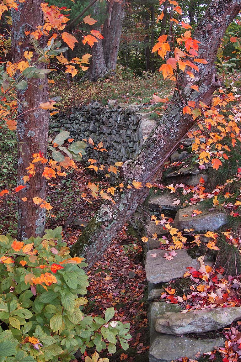 Remains of a bridge near Fisherman s Landing in Massasoit State Park. East Taunton, Massachusetts, October 18, 2003  Coral mushrooms near Kings Pond in Massasoit State Park. East Taunton, Massachusetts, September 20, 2003  A bumble-bee on a flower of periwinkle (vinca) near Middle Pond in Massasoit State Park. East Taunton, Massachusetts, May 3, 2003.  Flooded cranberry bog in the area of Perry Bogs of Massasoit State Park. East Taunton, Massachusetts, October 18, 2003  Pink brittlegill mushrooms (Russula) on Tattapanum Trail one mile north-east from Fall River. Massachusetts, July 13, 2003  Water lilies in south part of Leach Pond in Borderland State Park. Massachusetts, July 31, 2003  Water lilies in south part of Leach Pond in Borderland State Park. Massachusetts, July 31, 2003  Water lilies in south part of Leach Pond in Borderland State Park. Massachusetts, July 31, 2003  Indian pipe (ghost flower) plants from Tattapanum Trail one mile north-east from Fall River. Massachusetts, July 13, 2003  Fly agaric mushroom (Amanita muscaria toadstool) near Kings Pond in Massasoit State Park. East Taunton, Massachusetts, September 20, 2003  A forest at Tattapanum Trail 1 mile north-east from Fall River. Massachusetts, January 1, 2003.  A forest at Tattapanum Trail 1 mile north-east from Fall River. Massachusetts, January 1, 2003.  View from East Beach Road of Horseneck Beach. Westport, Massachusetts, July 31, 2003  Herring Gull near East Beach Road of Horseneck Beach. Westport, Massachusetts, July 31, 2003  South from Old Quarry in Freetown/Fall River State Forest. Massachusetts, May 24, 2003  Edible mushrooms Boletus Granulatus (Slippery Jack) near Kings Pond in Massasoit State Park. East Taunton, Massachusetts, October 18, 2003  Fighting Rock Corner in a forest one mile north-east from Fall River. Massachusetts, March 9, 2003.  Burned forest south from Old Quarry in Freetown/Fall River State Forest. Massachusetts, May 24, 2003  Burned forest south from Old Quarry in Freetown/Fall River State Forest. Massachusetts, May 24, 2003  Field of stones in a forest at Tattapanum Trail one mile north-east from Fall River. Massachusetts, March 16, 2003.  Abandoned stone wall in a forest from Tattapanum Trail 1 mile north-east from Fall River. Massachusetts, January 1, 2003.  Abandoned stone wall in a forest at Tattapanum Trail one mile north-east from Fall River. Massachusetts, March 16, 2003.  Abandoned stone wall in a forest from Tattapanum Trail one mile north-east from Fall River. Massachusetts, April 12, 2003.  Abandoned stone wall in a forest from Tattapanum Trail 1 mile north-east from Fall River. Massachusetts, January 1, 2003.  Holding pond behind cranberry bogs in the area of Perry Bogs of Massasoit State Park. East Taunton, Massachusetts, October 18, 2003  Hathaway Road in Freetown - Fall River State Forest. Massachusetts, July 12, 2003  Leeches on alligator s head on west shore of Elm Lake in Brazos Bend State Park. Needville, Texas, July 4, 2008  A butterfly on Payne Road in Freetown - Fall River State Forest. Massachusetts, July 12, 2003  North-east from observatory of Prudential Tower. Boston, Massachusetts, April 19, 2003  Doctor Durfee s Mill Pond in Freetown - Fall River State Forest. Massachusetts, July 12, 2003  Tattapanum Trail one mile north-east from Fall River. Massachusetts, March 16, 2003.  Tattapanum Trail 1 mile north-east from Fall River. Massachusetts, January 1, 2003.  Tattapanum Trail 1 mile north-east from Fall River. Massachusetts, January 1, 2003.  Tattapanum Trail one mile north-east from Fall River. Massachusetts, March 16, 2003.  Tattapanum Trail one mile north-east from Fall River. Massachusetts, March 16, 2003.  Tattapanum Trail one mile north-east from Fall River. Massachusetts, March 16, 2003.  View to the east from Skywalk observatory of Prudential Tower. Boston, Massachusetts, November 9, 2003, 4:45 p.m. |