 |
197-15. Abandoned fort on Mount Bental near a border with Syria. Golan Heights, the Middle East, April 7, 2001Similar picturesLarge thumbnails | Use small thumbnails | View as slideshow |
|
197-15. Abandoned fort on Mount Bental near a border with Syria. Golan Heights, the Middle East, April 7, 2001Similar picturesLarge thumbnails | Use small thumbnails | View as slideshow |
 Abandoned fort on Mount Bental near a border with Syria. Golan Heights, the Middle East, April 7, 2001  Abandoned fort on Mount Bental near a border with Syria. Golan Heights, the Middle East, April 7, 2001  Abandoned fort on Mount Bental near a border with Syria, with melting snow on Mount Hermon on background. Golan Heights, the Middle East, April 7, 2001  View to the direction of Beirut from Mount Bental near a border with Syria. Golan Heights, the Middle East, April 7, 2001  Growing actinidia (?) in an extinct volcano of Mount Bental near a border with Syria, with a top secret Israeli reconnaissance station on background. Golan Heights, the Middle East, April 7, 2001  Temple to Pan in Banias Park. Golan Heights, the Middle East, April 7, 2001  Cave of Pan and springs in Banias Park. Golan Heights, the Middle East, April 7, 2001  Eucalyptus in Israeli military base. Golan Heights, the Middle East, April 7, 2001  Kherouiaa village in Lebanon (?), view from Road 989. Golan Heights, the Middle East, April 7, 2001  Power station on Hermon River in Banias Park. Golan Heights, the Middle East, April 7, 2001  Skiing from Mount Hermon. Golan Heights, the Middle East, February 19, 2000  A view from Mount Hermon. Golan Heights, the Middle East, February 19, 2000  Cableway to Mount Hermon in Golan Heights. The Middle East. February 19, 2000  A lake and a road near Mount Hermon. Golan Heights, the Middle East, February 19, 2000  Decorated niche cut in rock cliff (in which a statue probably stood in the past) near a temple to the god of Pan in Banias Park. Golan Heights, the Middle East, April 7, 2001  Near the Banias Falls on Hermon River in Banias Park. Golan Heights, the Middle East, April 7, 2001  Banias Waterfall on Hermon River in Banias Park. Golan Heights, the Middle East, April 7, 2001  A road through Hermon Reserve. Golan Heights, the Middle East, February 19, 2000  An abandoned building in Tur Malka Russian monastery on Mount of Olives. Jerusalem, the Middle East, July 12, 2001  Morning view to south-east from Mount Yehoram, 3.5 miles north-west from Eilat. Mount Shelomo is on the background. The Middle East, November 4, 2001  Fort Metzad Halukim in Negev Desert 1 mile north from Sde Boker. The Middle East, April 9, 2001  Egyptian border near Taba, 3 miles south-east from Eilat. The Middle East, January 13, 2001  Egypt border near Taba, 3 miles south-east from Eilat. The Middle East, January 13, 2001  Mountains on Egypt border near Taba, 3 miles south-east from Eilat. The Middle East, January 13, 2001  A dry riverbed on Egyptian border near Taba, 3 miles south-east from Eilat. The Middle East, January 13, 2001  A trail near Egyptian border near Taba, 3 miles south-east from Eilat. The Middle East, January 13, 2001  Mountains on Egyptian border near Taba, 3 miles south-east from Eilat. The Middle East, January 13, 2001  View of Mount Zion, and south-eastern corner of City Wall from Mount of Olives. Jerusalem, the Middle East, July 12, 2001  View of Mount Zion, and south-eastern corner of City Wall from Mount of Olives. Jerusalem, the Middle East, July 12, 2001  Abandoned Jewish cemetery on slopes of Mount of Olives. Jerusalem, the Middle East, January 11, 2002  A garden in the abandoned village Soofla, 3 miles east from Beit Shemesh. The Middle East, July 5, 2001  A cave in the abandoned village Soofla, 3 miles east from Beit Shemesh. The Middle East, July 5, 2001  A garden in the abandoned village of Soofla, 3 miles east from Beit Shemesh. The Middle East, July 5, 2001  Ancient columbarium caves (?) in an abandoned Arab village of Bet Atab, 4 miles east from Beit Shemesh. The Middle East, July 5, 2001  View to the north from Mount Yehoram, 3.5 miles north-west from Eilat. Mount Shehoret is on horizon. The Middle East, November 4, 2001  View of valley of Nahal Roded creek and Mount Shehoret to the north from Mount Yehoram, 3.5 miles north-west from Eilat. The Middle East, November 4, 2001  A trail going east from Mount Tzefahot to Field Study School, near Coral Beach 3 miles south-east from Eilat. The Middle East, January 13, 2001  Abandoned building of the Great Mosque. Beer-Sheva, the Middle East, November 18, 2001  Masada marls, view to the east from Mount Eliazar, near the Dead Sea. The Middle East, November 8, 2001  View to the east from Mount Shelomo, 2.5 miles north-west from Eilat. The Middle East, November 4, 2001  Abandoned graves in Moslem cemetery in central Beer-Sheva. The Middle East, March 23, 2001  Abandoned graves in Moslem cemetery in central Beer-Sheva. The Middle East, March 23, 2001  Eery passage of Via Dolorosa abandoned by tourists in Old City. Jerusalem, the Middle East, July 12, 2001  Poppies in abandoned Moslem cemetery in central Beer-Sheva. The Middle East, March 23, 2001  Metzad Tamar fort near Road 25 from Dimona to Dead Sea. The Middle East, November 29, 2001  Moon Valley in Sinai across Egyptian border, view from Road 12, 5 miles west from Eilat. The Middle East, December 13, 2001  Masada marls (powdery chalk wadi), view to the east from Mount Eliazar, near the Dead Sea. The Middle East, November 8, 2001  Masada marls (powdery chalk wadi), view to the east from Mount Eliazar, near the Dead Sea. The Middle East, November 8, 2001  A river going west near Mount Tzefahot, near Coral Beach 3 miles south-east from Eilat. The Middle East, January 13, 2001  A trail going west(?) near Mount Tzefahot, near Coral Beach 3 miles south-east from Eilat. The Middle East, January 13, 2001  View to the north from Mount Tzefahot, near Coral Beach 3 miles south-east from Eilat. The Middle East, January 13, 2001  A trail going west near Mount Tzefahot, near Coral Beach 3 miles south-east from Eilat. The Middle East, January 13, 2001  A trail going north from Mount Tzefahot, near Coral Beach 3 miles south-east from Eilat. The Middle East, January 13, 2001  View to the west (Egypt) from Mount Tzefahot, near Coral Beach 3 miles south-east from Eilat. The Middle East, January 13, 2001  View of Haifa and a bay from Mount Carmel. The Middle East, January 28, 2001  A jeep road 1 mile south-east from Netafim Border Check Point from Ma ale Eilat Road, 3 miles north-west from Eilat. The Middle East, March 22, 2001  View from a lookout of Mount Sdom to the south. The Middle East, December 27, 2001  Hebrew University on Mount Scopus. Jerusalem, the Middle East, March 1, 2001  View from a trail on Mount Sdom to the north. The Middle East, December 27, 2001  View from a lookout of Mount Sdom to the north. The Middle East, December 27, 2001  View from a lookout of Mount Sdom to the north. The Middle East, December 27, 2001  Bee s nest on a roadside west from Mount Sdom. The Middle East, December 27, 2001  Abandoned Arab farm east from Tirat Carmel near Haifa. The Middle East, April 25, 2002  Abandoned Arab house east from Tirat Carmel near Haifa. The Middle East, April 25, 2002  View of Road 12 (Eilat ascent) to direction of Netafim border crossing north from Mount Yoash, 4 miles north-west from Eilat. The Middle East, January 17, 2002  View from a lookout of Mount Sdom to the south-west. The Middle East, December 27, 2001 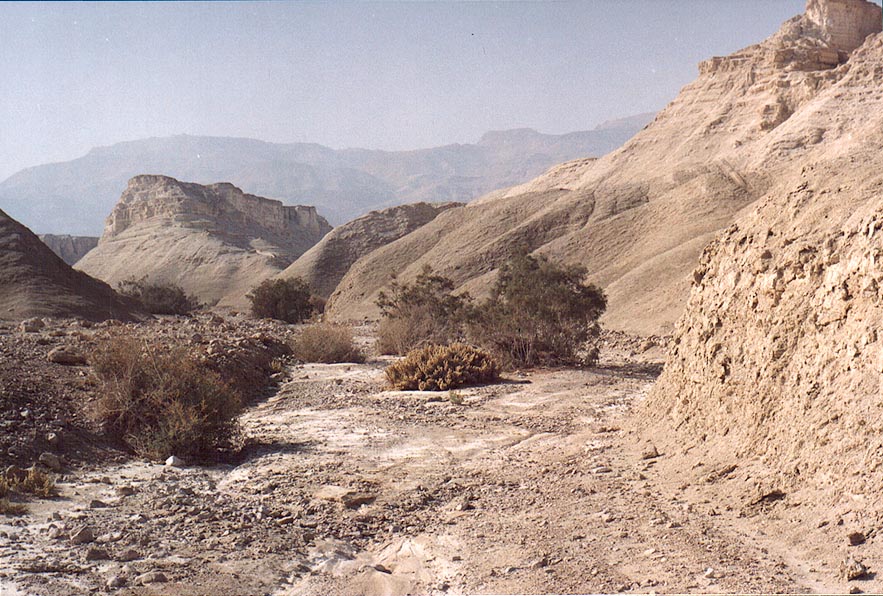 Wadi of Nahal Pratzim, west from Mount Sdom. The Middle East, December 27, 2001  A.S. on Mount Yehoram, 3.5 miles north-west from Eilat. The Middle East, November 4, 2001  Mary s Tomb on the foot of Mount of Olives. Jerusalem, the Middle East, July 12, 2001  View of Haifa from Bahai Temple on Mount Carmel. The Middle East, January 28, 2001  Haifa on the slope of Mount Karmel, view from a train. The Middle East, June 7, 2001  Bahai Temple on Mount Carmel, with oranges. Haifa, the Middle East, January 28, 2001  Dead Sea to the west, behind the rim of Mount Yishai lookout, above Ein Gedi. The Middle East, November 15, 2001  Eilat hotels at Red Sea, view from Mount Shahmon at evening. The Middle East, December 13, 2001  View of Dead Sea from a lookout of Mount Sdom to the north. The Middle East, December 27, 2001  View of Haifa, a bay and a northern coast from Mount Carmel. The Middle East, January 28, 2001  View to north-east from Mount Shelomo, 2.5 miles north-west from Eilat. The Middle East, November 4, 2001  View to north-east from Mount Shelomo, 3 miles north-west from Eilat. The Middle East, March 22, 2001  View to north-east from Mount Shelomo, 2.5 miles north-west from Eilat. The Middle East, November 4, 2001  Ramon Crater east from Mitzpe Ramon, with Road 40 to Eilat, and Mount Ardon in background. The Middle East, December 19, 2001  Ramon Crater east from Mitzpe Ramon, view from a jeep road, near Mount Gevanim(?). The Middle East, December 19, 2001  Akaba at Red Sea and Edom Mountains, view from Mount Shahmon at evening. The Middle East, December 13, 2001  Bahai garden (left from an entrance) on Mount Carmel. Haifa, the Middle East, January 28, 2001  Slopes of Mount Shelomo, 2.5 miles north-west from Eilat. The Middle East, November 4, 2001  View of Masada hill north from Mount Eliazar, near the Dead Sea. The Middle East, November 8, 2001  View of Dead Sea from a lookout of Mount Sdom to the south-west. The Middle East, December 27, 2001  View of Kidron Valley and Old City from Mount of Olives. Jerusalem, the Middle East, July 12, 2001  A church in Tur Malka Russian monastery on Mount of Olives. Jerusalem, the Middle East, July 12, 2001  View of Solomon s Stables and El-Aqs Mosque from Mount of Olives. Jerusalem, the Middle East, July 12, 2001 |


