 |
207-24. A wadi along Road 31 from Arad to Dead Sea, 1 mile south-west from Arad, view from a bus. The Middle East, May 17, 2001Similar picturesLarge thumbnails | Use small thumbnails | View as slideshow |
|
207-24. A wadi along Road 31 from Arad to Dead Sea, 1 mile south-west from Arad, view from a bus. The Middle East, May 17, 2001Similar picturesLarge thumbnails | Use small thumbnails | View as slideshow |
 View from Road 31 from Arad to Dead Sea. The Middle East, January 20, 2001  View of Zohar gorge from a road from Arad to the Dead Sea. The Middle East, September 29, 2001  Sunset over Judean Desert, view from the road from Dead Sea to Arad. The Middle East, November 8, 2001  View of Tsuk Tamrur hill in Judean Desert from a road from Arad to the Dead Sea. The Middle East, September 29, 2001  H. Kasif (?) Bedouin village west from Arad, view from Road 31. The Middle East, January 20, 2001  Soldiers practicing in Negev Desert along Road 31, a few miles west from Arad, view from a bus. The Middle East, May 17, 2001  View of the Dead Sea from the opening of the lower Nahal Peres Canyon 1 mile north-west and above Arava junction (Road 25 to Dead Sea), 17 miles east from Dimona, view to the east. The Middle East, May 10, 2001  View of Tsuk Tamrur hill from ascent from Dead Sea to Arad at evening. The Middle East, January 24, 2002  Bedouin camels from a road descending from Arad to Neve Zohar on Dead Sea. The Middle East, November 2, 2002  Beginning of the lower Nahal Peres Canyon 1 mile north-east from Tamar ascent to Dead Sea (Road 25), 17 miles east from Dimona, view to the west. The Middle East, May 10, 2001  Approaching the end of the lower Nahal Peres Canyon 1 mile north-west and above Arava junction (Road 25 to Dead Sea), 17 miles east from Dimona, view to the north. The Middle East, May 10, 2001  Creeks going through marls (powdery chalk substance) to Dead Sea, view to the east from Roman road 1 mile north from Masada. The Middle East, May 17, 2001  Lower Nahal Peres Canyon 1 mile north-west and above Arava junction (Road 25 to Dead Sea), 17 miles east from Dimona, view from Maale Peres to the north-west. The Middle East, May 10, 2001  Descent to Dead Sea along Nahal Peres River and a jeep road in the plateau near Har Tsurim, 2 miles north from Tamar ascent to Dead Sea (Road 25), 15 miles east from Dimona, view to the south to the direction of Dead Sea. The Middle East, May 10, 2001  Wadi in the area of Nahal Rahaf, view to the south from Mount Eliazar, near the Dead Sea. The Middle East, November 8, 2001  Bedouin village from a road from Beer-Sheva to Arad. The Middle East, November 2, 2002  View of Dead Sea east from Maale Peres, 0.5 miles north-west and above Arava junction (Road 25 to Dead Sea), 17 miles east from Dimona. The Middle East, May 10, 2001  View of the Dead Sea Works from the opening of Nahal Peres Canyon 0.5 miles north-west and above Arava junction (Road 25 to Dead Sea), 17 miles east from Dimona, view to the north-east. The Middle East, May 10, 2001  Masada marls (powdery chalk wadi), view to the east from Mount Eliazar, near the Dead Sea. The Middle East, November 8, 2001  Masada marls (powdery chalk wadi), view to the east from Mount Eliazar, near the Dead Sea. The Middle East, November 8, 2001  A jeep road 1 mile south-east from Netafim Border Check Point from Ma ale Eilat Road, 3 miles north-west from Eilat. The Middle East, March 22, 2001  View of Dead Sea Works north-west from Maale Peres, 0.5 miles north-west and above Arava junction (Road 25 to Dead Sea), 17 miles east from Dimona. The Middle East, May 10, 2001  View of Dead Sea from a lookout of Mount Sdom to the south-west. The Middle East, December 27, 2001  Wadi in the area of Nahal Tseelim, view to the north from Mount Eliazar, near the Dead Sea. The Middle East, November 8, 2001  Zoomed view of the Dead Sea Works at distance of 4 miles north-east from Maale Peres from a place 0.5 miles north-west and above Arava junction (Road 25 to Dead Sea), 17 miles east from Dimona. The Middle East, May 10, 2001  Descent to Dead Sea along Nahal Peres River, 2 miles north from Tamar ascent to Dead Sea (Road 25), 15 miles east from Dimona, 400 m south from a jeep road. The Middle East, May 10, 2001  Descent to Dead Sea along Nahal Peres River, 2 miles north from Tamar ascent to Dead Sea (Road 25), 15 miles east from Dimona, 300 m south from a jeep road. The Middle East, May 10, 2001  Descent to Dead Sea along Nahal Peres River, 2 miles north from Tamar ascent to Dead Sea (Road 25), 15 miles east from Dimona, 500 m south from a jeep road. The Middle East, May 10, 2001  Descent to Dead Sea along Nahal Peres River, 2 miles north from Tamar ascent to Dead Sea (Road 25), 15 miles east from Dimona, 250 m south from a hill and a jeep road. The Middle East, May 10, 2001  Descent to Dead Sea along Nahal Peres River, 2 miles north from Tamar ascent to Dead Sea (Road 25), 15 miles east from Dimona, 200 m south from a hill and a jeep road. The Middle East, May 10, 2001  Descent to Dead Sea along Nahal Peres River and a jeep road in the plateau near Har Tsurim, 2 miles north from Tamar ascent to Dead Sea (Road 25), 15 miles east from Dimona, view to the north with Har Hamarma (?) at the horizon. The Middle East, May 10, 2001  View of a canyon in Ein Bokek from a road along the Dead Sea. The Middle East, September 29, 2001  Nahal Mor (?) river, view from a road along Dead Sea. The Middle East, March 29, 2001  View of hills at the bottom of Ramon Crater from distance of 1 mile to the south-east from Mitzpe Ramon Visitor s Center. The Middle East, May 3, 2001  Tseelim River, view from Roman road along Dead Sea from Masada. The Middle East, May 17, 2001  A waterfall at the end of Nahal Peres Canyon, view to north-west from Maale Peres, 0.5 miles north-west and above Arava junction (Road 25 to Dead Sea), 17 miles east from Dimona. The Middle East, May 10, 2001  A waterfall at the end of Nahal Peres Canyon (with water pools), view to north-west from Maale Peres, 0.5 miles north-west and above Arava junction (Road 25 to Dead Sea), 17 miles east from Dimona. The Middle East, May 10, 2001  2 miles north from Tamar ascent to Dead Sea (Road 25), 15 miles east from Dimona, 100 m south from a hill and a jeep road (there is a deep canyon of Nahal Peres to the right). The Middle East, May 10, 2001  Nahal Peres River 2 miles north from Tamar ascent to Dead Sea (Road 25), 15 miles east from Dimona, 100 m south from a hill and a jeep road (there is a deep canyon to the right). The Middle East, May 10, 2001  A terrace and opening of Tseelim Canyon to Dead Sea, view from Roman road from Masada. The Middle East, May 17, 2001  Masada fortress on the top of a hill, view from Roman road 1 mile north from Masada at evening. The Middle East, May 17, 2001  Streams and small canyons carved in soft limestone in the direction of Dead Sea, view to the east from Roman road 0.5 miles north from Masada. The Middle East, May 17, 2001  Descent to Dead Sea along Nahal Peres River and a jeep road in the area of Har Tsurim, 2 miles north from Tamar ascent to Dead Sea (Road 25), 15 miles east from Dimona. The Middle East, May 10, 2001  Descent to Dead Sea along Nahal Peres River and a jeep road in the area of Har Tsurim, 2 miles north from Tamar ascent to Dead Sea (Road 25), 15 miles east from Dimona. The Middle East, May 10, 2001  Descent to Dead Sea along Nahal Peres River and a jeep road in the area of Har Tsurim, 2 miles north from Tamar ascent to Dead Sea (Road 25), 15 miles east from Dimona. The Middle East, May 10, 2001  Descent to Dead Sea along Nahal Peres River and a jeep road in the plateau near Har Tsurim, 2 miles north from Tamar ascent to Dead Sea (Road 25), 15 miles east from Dimona. The Middle East, May 10, 2001  View of Arava junction from Maale Peres, 0.5 miles north-west and above Arava junction (Road 25 to Dead Sea), 17 miles east from Dimona. The Middle East, May 10, 2001  View of a trail west from Masada from Mount Eliazar, near the Dead Sea. The Middle East, November 8, 2001  Northern side of opening of Peres canyon, view to the north from Maale Peres, 0.5 miles north-west and above Arava junction (Road 25 to Dead Sea), 17 miles east from Dimona. The Middle East, May 10, 2001  Streams and small canyons (Masada Marls) in the direction of Dead Sea, view to the east from Roman road 0.5 miles north from Masada. The Middle East, May 17, 2001  Dry wadi and Dead Sea, view from a trail north from Masada. The Middle East, December 7, 2000  View of Dead Sea and misty Moav Mountains from a lookout of Mount Sdom to the west. The Middle East, December 27, 2001  Descent to Dead Sea along Nahal Peres River in the plateau near Har Tsurim, 2 miles north from Tamar ascent to Dead Sea (Road 25), 15 miles east from Dimona. The Middle East, May 10, 2001  View of Timna Mountains to the south-west from entrance road to Timna Park. The Middle East, March 15, 2001  View of Qeren Akev Mt. behind Zin valley from Ma ale Zin Road, 2 miles south-east from Sde Boker. The Middle East, April 9, 2001  View of Ben Gurion tomb (in the center) and Ben Gurion College at Sde Boker from 1 mile distance to the north on the opposite side of 100 m deep Tzin canyon (the serpent road goes down to Ein Avdat Reserve). The Middle East, February 15, 2001  Desert acacia in bloom along the Roman road 1 mile north from Masada. The Middle East, May 17, 2001  A wadi approaching Ramon s Tooth (black hill) from the south, 6 miles south-east from Mitzpe Ramon. The Middle East, May 3, 2001  A wadi approaching Ramon s Tooth (black hill) from the south, 6 miles south-east from Mitzpe Ramon. The Middle East, May 3, 2001  Masada marls, view to the east from Mount Eliazar, near the Dead Sea. The Middle East, November 8, 2001  Bottom of Ramon Crater, view to the south-west, 4 miles south-east from Mitzpe Ramon. The Middle East, May 3, 2001  View of the Negev Desert to the west along Nahal Nekarot River, 6 miles south-east from Mitzpe Ramon. The Middle East, May 3, 2001  View to the west (Egypt) from Mount Tzefahot, near Coral Beach 3 miles south-east from Eilat. The Middle East, January 13, 2001  View from a wadi near copper mines in western Timna Park, near Eilat. The Middle East, April 25, 2001  View from a wadi near copper mines in western Timna Park, near Eilat. The Middle East, April 25, 2001  View of a valley of Zin River from a serpent road south from Ben Gurion College at Sde Boker. The Middle East, February 15, 2001  Negev Desert south from Ramon crater, near Har Shizzafon (?), view from a bus on Road 40 to Eilat. The Middle East, March 22, 2001  View from a lookout of Mount Sdom to the south-west. The Middle East, December 27, 2001  Junk yard of Dead Sea Works on Red Sea beach 2 miles south-east from Eilat, with Akaba and mountains in Jourdan behind it. The Middle East, January 13, 2001  Southern side of Ramon Crater near the road to Eilat, view to the east from Ramon s Tooth, 5 miles south-east from Mitzpe Ramon. The Middle East, May 3, 2001  View of Dead Sea from a lookout of Mount Sdom to the north. The Middle East, December 27, 2001  View of Dead Sea near Ein Bokek from the southern side of the canyon. The Middle East, February 22, 2001  View of swampy area in southern part of the Dead Sea from a bus. The Middle East, September 29, 2001  Negev Desert south from Ramon crater, near Paran River (?), view from a bus on Road 40 to Eilat. The Middle East, March 22, 2001  Negev Desert south from Ramon crater, near Paran River (?), view from a bus on Road 40 to Eilat. The Middle East, March 22, 2001  Negev Desert south from Ramon crater, near Paran River (?), view from a bus on Road 40 to Eilat. The Middle East, March 22, 2001  Negev Desert south from Ramon crater, near Paran River (?), view from a bus on Road 40 to Eilat. The Middle East, March 22, 2001  Metzad Tamar fort near Road 25 from Dimona to Dead Sea. The Middle East, November 29, 2001  View of Masada hill north from Mount Eliazar, near the Dead Sea. The Middle East, November 8, 2001  View of Masada hill north from Mount Eliazar, near the Dead Sea. The Middle East, November 8, 2001  View of Dead Sea and Ein Bokek hotels from the southern side of the canyon. The Middle East, February 22, 2001 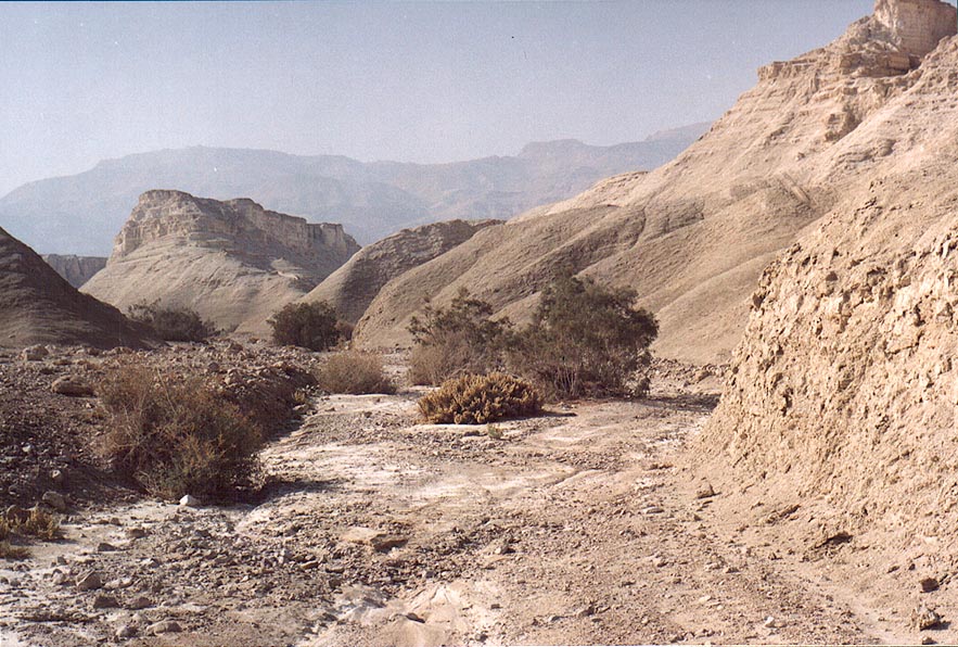 Wadi of Nahal Pratzim, west from Mount Sdom. The Middle East, December 27, 2001  View to the south from Mount Yehoram, 3.5 miles north-west from Eilat. The Middle East, November 4, 2001  Desert acacia on an old Roman road along Dead Sea from Masada to Tseelim spring. The Middle East, May 17, 2001  View of Dead Sea salt pans near Ein Bokek from the southern side of the canyon. The Middle East, February 22, 2001  View of Masada hill north from Mount Eliazar, near the Dead Sea (sun in clouds). The Middle East, November 8, 2001  View of Masada hill north from Mount Eliazar, near the Dead Sea (bright sun). The Middle East, November 8, 2001  A hill west from Masada, near the Dead Sea. The Middle East, November 8, 2001  Chalky wadi of Nahal Pratzim, west from Mount Sdom. The Middle East, December 27, 2001  A wadi in Tseelim Canyon, 3.5 miles north-west from Masada. The Middle East, September 29, 2001  A wadi near Roded ascent, 4 miles north-west from Eilat. The Middle East, December 13, 2001  Tel Sharuhen hill (view from the south) in Eshkol Park 10 miles west from Ofakim. The Middle East, February 27, 2001  Eilat and Aqaba, view to south-east from Mount Shelomo, 3 miles north-west from Eilat. The Middle East, March 22, 2001  View to the direction of Masada from Maale Bokek Ascent (there is a mysterious glow of Dead Sea). The Middle East, February 22, 2001  Snake path to Masada hill, view to the north from Mount Eliazar, near the Dead Sea. The Middle East, November 8, 2001 |


