 |
243-26. Chalky wadi of Nahal Pratzim, west from Mount Sdom, near Flour Cave. The Middle East, December 27, 2001Similar picturesLarge thumbnails | Use small thumbnails | View as slideshow |
|
243-26. Chalky wadi of Nahal Pratzim, west from Mount Sdom, near Flour Cave. The Middle East, December 27, 2001Similar picturesLarge thumbnails | Use small thumbnails | View as slideshow |
 Chalky wadi of Nahal Pratzim, west from Mount Sdom. The Middle East, December 27, 2001  Chalky plateau of Mishor Amiaz, west from Mount Sdom, near Flour Cave. The Middle East, December 27, 2001 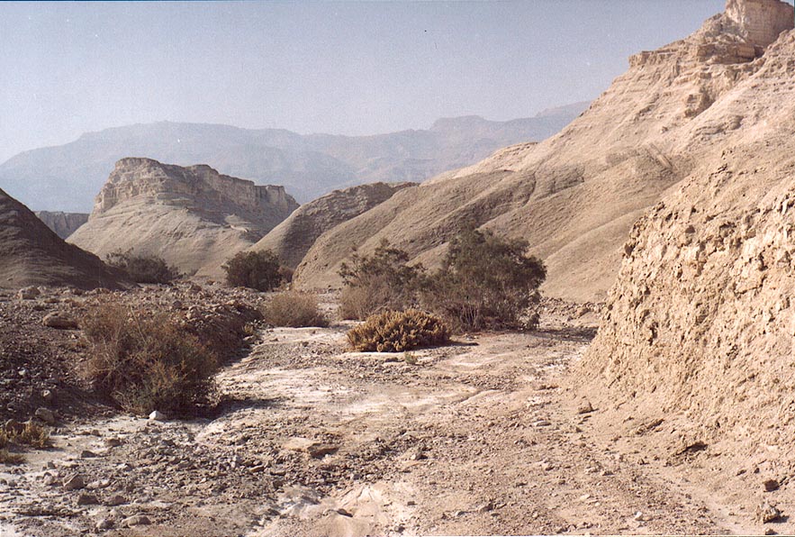 Wadi of Nahal Pratzim, west from Mount Sdom. The Middle East, December 27, 2001  Bee s nest on a roadside west from Mount Sdom. The Middle East, December 27, 2001  View from a lookout of Mount Sdom to the south-west. The Middle East, December 27, 2001  View of Dead Sea from a lookout of Mount Sdom to the south-west. The Middle East, December 27, 2001  Salt rock layer of Mount Sdom, from north-west side. The Middle East, December 27, 2001  View of Dead Sea and misty Moav Mountains from a lookout of Mount Sdom to the west. The Middle East, December 27, 2001  View from a trail on Mount Sdom to the north. The Middle East, December 27, 2001  View from a lookout of Mount Sdom to the north. The Middle East, December 27, 2001  View from a lookout of Mount Sdom to the south. The Middle East, December 27, 2001  View from a lookout of Mount Sdom to the north. The Middle East, December 27, 2001  View of Dead Sea from a lookout of Mount Sdom to the north. The Middle East, December 27, 2001  Salt marsh with tamarisk at Emek Zahar north from Mount Sdom. The Middle East, December 27, 2001  A dumping ground at Emek Zahar marsh north from Mount Sdom. The Middle East, December 27, 2001  Wadi in the area of Nahal Rahaf, view to the south from Mount Eliazar, near the Dead Sea. The Middle East, November 8, 2001  Wadi in the area of Nahal Tseelim, view to the north from Mount Eliazar, near the Dead Sea. The Middle East, November 8, 2001  Iscandria flour mill (?) at Nahal Ammud River near Safed. The Middle East, April 19, 2001  Nahal Roded wadi with Mount Shehoret at background, 3 miles north-west from Eilat. The Middle East, March 14, 2002  Wadi Natuf valley with Wayfarer s shelter and cave cistern in Neot Kedumim biblical landscape park, west from Jerusalem. The Middle East, February 7, 2001  View of valley of Nahal Roded creek and Mount Shehoret to the north from Mount Yehoram, 3.5 miles north-west from Eilat. The Middle East, November 4, 2001  Narrowing of the canyon of Nahal Mapalim creek, wadi of the falls , 3 miles north-west from Eilat. The Middle East, March 22, 2001  Nahal Gevanimat wadi in Ramon Crater, with Mount Marpeq(?) at horizon. The Middle East, May 9, 2002  Gnawed skull of a small animal in a cave at Nahal Darokh river 4.5 miles east from Sde Boker. The Middle East, April 9, 2001  Masada marls (powdery chalk wadi), view to the east from Mount Eliazar, near the Dead Sea. The Middle East, November 8, 2001  Masada marls (powdery chalk wadi), view to the east from Mount Eliazar, near the Dead Sea. The Middle East, November 8, 2001  Upper Nahal Mapalim creek north from Mount Shelomo, 3 miles north-west from Eilat. The Middle East, March 22, 2001  Start of Nahal Mapalim creek with a trail going north from Mount Shelomo, 3 miles north-west from Eilat. The Middle East, March 22, 2001  Nahal Sekhvee River north from Safed, landscape of a wadi in Upper Galilee. The Middle East, April 19, 2001  A wadi near Roded ascent, 4 miles north-west from Eilat. The Middle East, December 13, 2001  Netafim Creek west from Mount Shahmon, 2 miles north-west from Eilat. The Middle East, December 13, 2001  Netafim Creek west from Mount Shahmon, 2 miles north-west from Eilat. The Middle East, December 13, 2001  Netafim Creek west from Mount Shahmon, 2 miles north-west from Eilat. The Middle East, December 13, 2001  Morning view to south-east from Mount Yehoram, 3.5 miles north-west from Eilat. Mount Shelomo is on the background. The Middle East, November 4, 2001  Western slopes of Mount Shahmon, 2 miles north-west from Eilat. The Middle East, December 13, 2001  Roded Wadi and Mount Shehoret north from Eilat. The Middle East, December 9, 2002  Nahal Gishron wadi 3 miles west from Eilat. The Middle East, October 17, 2002  Nahal Tzefahot wadi, 3 miles south-west from Eilat. The Middle East, October 17, 2002  Nahal Roded wadi 3 miles north-west from Eilat. The Middle East, March 14, 2002  Nahal Shani wadi approaching Nahal Raham, 8 miles north from Eilat. The Middle East, February 7, 2002  Nahal Shani wadi approaching Nahal Raham, 8 miles north from Eilat. The Middle East, February 7, 2002  Under acacia in Nahal Shani wadi approaching Nahal Raham, 8 miles north from Eilat. The Middle East, February 7, 2002  Acacia in Nahal Shani wadi approaching Nahal Raham, 8 miles north from Eilat. The Middle East, February 7, 2002  View of beginning of Roded wadi from Mount Shehoret, north from Eilat. The Middle East, December 9, 2002  A succulent plant in Nahal Shani wadi approaching Nahal Raham, 8 miles north from Eilat. The Middle East, February 7, 2002  Wadi Gishron with Mount Shlomo on horizon 3 miles west from Eilat. The Middle East, October 17, 2002  View of a cave from trail 2223 overlooking canyon of Nahal Keziv river, 2 miles north-west from Mi ilia. Galilee, the Middle East, March 31, 2002  Flour mill, with Ein Gedi and Dead Sea on background. The Middle East, March 29, 2001  View to the north from Mount Yehoram, 3.5 miles north-west from Eilat. Mount Shehoret is on horizon. The Middle East, November 4, 2001  A cabbage like spring plant in Nahal Botem wadi west from Timna Park, 16 miles north from Eilat. The Middle East, February 14, 2002  A cabbage like spring plant in Nahal Botem wadi west from Timna Park, 16 miles north from Eilat. The Middle East, February 14, 2002  View of Roded Valley with Mount Shehoret to the left from Byzantine (?) quarries of Boded (Lost) City, 4 miles north-west from Eilat. The Middle East, December 13, 2001  View to the east from Mount Shelomo, 2.5 miles north-west from Eilat. The Middle East, November 4, 2001  Beginning of the lower Nahal Peres Canyon 1 mile north-east from Tamar ascent to Dead Sea (Road 25), 17 miles east from Dimona, view to the west. The Middle East, May 10, 2001  A wadi in Tseelim Canyon, 3.5 miles north-west from Masada. The Middle East, September 29, 2001  View of Wadi Shehoret entering Arava Valley from Mount Shehoret, north from Eilat. The Middle East, December 9, 2002  View of Wadi Shehoret entering Arava Valley from Mount Shehoret, north from Eilat. The Middle East, December 9, 2002  A tributary of Nahal Divshon creek, view to north-west from a trail 1.5 miles east from Avdat. The Middle East, February 15, 2001  View of the Negev Desert to the west along Nahal Nekarot River, 6 miles south-east from Mitzpe Ramon. The Middle East, May 3, 2001  Canyon of Nahal Gov wadi, 13 miles east from Yeroham. The Middle East, March 23, 2002  Canyon of Nahal Gov wadi, 13 miles east from Yeroham. The Middle East, March 23, 2002  Stones of Nahal Gov wadi, 13 miles east from Yeroham. The Middle East, March 23, 2002  Stones of Nahal Gov wadi, 13 miles east from Yeroham. The Middle East, March 23, 2002  Stones of Nahal Gov wadi, 13 miles east from Yeroham. The Middle East, March 23, 2002  Stalactites in Sorek Cave, west from Jerusalem. The Middle East, December 30, 2000  Stalactites in Sorek Cave, west from Jerusalem. The Middle East, December 30, 2000  A trail going west(?) near Mount Tzefahot, near Coral Beach 3 miles south-east from Eilat. The Middle East, January 13, 2001  A trail going west near Mount Tzefahot, near Coral Beach 3 miles south-east from Eilat. The Middle East, January 13, 2001  A river going west near Mount Tzefahot, near Coral Beach 3 miles south-east from Eilat. The Middle East, January 13, 2001  Nahal Hatira wadi, 8 miles south-east from Yeroham. The Middle East, March 2, 2002  Approaching the canyon of Nahal Gov wadi, 13 miles east from Yeroham. The Middle East, March 23, 2002  Ibexes in Nahal Akev wadi, 2.5 miles east from Avdat. The Middle East, November 17, 2002  Nahal Hatira wadi, 8 miles south-east from Yeroham. The Middle East, March 2, 2002  A narrowing wadi in Tseelim Canyon, 3.5 miles north-west from Masada. The Middle East, September 29, 2001  A short tributary of Nahal Akev creek, view to north-west from a trail 2 miles east from Avdat. The Middle East, February 15, 2001  Nahal Shani wadi east from Red canyon, 8 miles north from Eilat. The Middle East, February 7, 2002  Nahal Shani wadi east from Red canyon, 8 miles north from Eilat. The Middle East, February 7, 2002  Nahal Shani wadi east from Red Canyon, 8 miles north from Eilat. The Middle East, February 7, 2002  Nahal Shani wadi east from Red canyon, 8 miles north from Eilat. The Middle East, February 7, 2002  Riverbed of Nahal Hatira wadi, 8 miles south-east from Yeroham. The Middle East, March 2, 2002  A big fall of Nahal Yamin wadi, 8 miles south-east from Yeroham. The Middle East, March 2, 2002  View to the west (Egypt) from Mount Tzefahot, near Coral Beach 3 miles south-east from Eilat. The Middle East, January 13, 2001  Wall of stalactites in Sorek Cave, west from Jerusalem. The Middle East, December 30, 2000  Shimshon Cave at Sorek River, west from Jerusalem. The Middle East, December 30, 2000  A side wadi of Nahal Shani east from Red Canyon, 8 miles north from Eilat. The Middle East, February 7, 2002  Yachnuk flowers in Nahal Hatira wadi, 8 miles south-east from Yeroham. The Middle East, March 2, 2002  Desert landscape of canyon of Nahal Akev wadi, 2.5 miles east from Avdat. The Middle East, November 17, 2002  Meander of Nahal Yamin wadi before a big fall, 8 miles south-east from Yeroham. The Middle East, March 2, 2002  Yachnuk flowers in Nahal Yamin wadi, 8 miles south-east from Yeroham. The Middle East, March 2, 2002  Eilat hotels at Red Sea, view from Mount Shahmon at evening. The Middle East, December 13, 2001  An acacia tree where Mapalim Creek joins Netafim Creek, at the head of Trail of Falls to Mount Shelomo, 2.5 miles north-west from Eilat. The Middle East, December 13, 2001  Nahal Hatira wadi ascending to En Yorqe am spring, 8 miles south-east from Yeroham. The Middle East, March 2, 2002  Descent to Nahal Yamin wadi bypassing the fall, 8 miles south-east from Yeroham. The Middle East, March 2, 2002  Bright yellow sands in Nahal Yamin wadi, 8 miles south-east from Yeroham. The Middle East, March 2, 2002  Bright yellow sands in Nahal Yamin wadi, 8 miles south-east from Yeroham. The Middle East, March 2, 2002  Yellow tainted stalactites in Sorek Cave, west from Jerusalem. The Middle East, December 30, 2000  Akaba at Red Sea and Edom Mountains, view from Mount Shahmon at evening. The Middle East, December 13, 2001 |

